How the Last Ice Age Shaped Flatbush
It’s not hyperbolic to state that the last Ice Age ended at the edge of Flatbush. That is to say, during the Wisconsin Glaciation, the giant glacier known as the Laurentide Ice Sheet grew and expanded south from present day Labrador into the United States, then slowly ground to a halt right here, just a few blocks north of Empire Blvd — its edge extending down into Prospect Park, through Green-Wood Cemetery, into what’s now the Harbor and then, onto Staten Island.
The bedrock of Long Island was formed long before the glacier arrived (for geology purposes, we must admit that Brooklyn is part of Long Island). But the land hadn’t always been at that location. If you’ve ever heard of Pangea, you probably remember that it was a giant landmass near the equator that existed before the seven continents we have today. Pangea was broken apart by underground forces when the Atlantic Ocean was born, splitting the craggy eastern seaboard of the present-day US away from northern Africa and sending it halfway across the globe as the ocean grew and grew.

This map shows where New York City was located when we were all part of one giant landmass known as Pangea. (source: US Geological Survey)
Meanwhile, a couple of mini-starter oceans were forming on the future east coast of the United States: the Hartford Basin and the Newark Basin. But they weren’t as successful as the Atlantic Ocean (which is still expanding even today), and they soon filled with volcanic stone and other sentiment, like sandstone and mudrocks. Today, we call the filled-in portions of the Newark Basin the Palisades, and you can get a good look at them if you’re in Washington Heights or heading north out of the city in a car.
Over in the Hartford Basin, which extended across central Connecticut and into southern Massachusetts, water began to overflow. Long Island Sound formed along its southern edge, and more silt was deposited on top of the underground bedrock present in the area. And thus, Long Island was formed.
There it sat, undergoing various ages and eras, until it was covered by the Laurentide Ice Sheet, a mere 12,000–25,000 years ago. And then the Laurentide did what glaciers do: it receded. It did not pack up its things and go nicely back to Canada. It deposited boulders in Central Park, helped shape massive lakes (both Great and Finger), and left a tall ridge of rock on the future border of Flatbush known as a terminal moraine.
On the other side of the terminal moraine was now a massive drop. Ice-age-sized waterfalls deposited rocks, sand, and silt — known as outwash plain — and formed the entire southern half of Long Island, including the southern half of what’s now Brooklyn. The mixture of loose sand, soil, and pebbles it left behind (sometimes called “Wisconsin till”) was perfect for growing roots. Woodlands developed, including (eventually) oak and hickory trees, and humans arrived, gathering its bounty and hunting its animals. The Lenape burned the edges of the forest, helping the underbrush preferred by ground birds and small mammals to grow and keeping the ecosystem in a healthy cycle.
The native people preferred to farm closer to the river, where there was a freshwater source. But the Dutch used slave labor to chop down trees, dig wells, and irrigate their crops. They formed Flatbush based on the geology and biology they found before them. The town began just south of the terminal moraine, went west to the salt flats, and was built on Wisconsin till in which crops flourished. Where glacial waterfalls and flowing rivers had packed the Earth into clay just south of the moraine (in present-day Prospect Lefferts Gardens), they dug up bricks and built their first homes. Later, the front-facing side of many row houses built in the area would be slathered in brownstone, a.k.a. ground-up sandstone and mudrock quarried from the Hartford Basin.
The people who lived near the terminal moraine began calling it “The Guan,” “Guan Heights” or “The Heights of Guan,” a word that’s likely to have a Native American origin. It was on The Heights of Guan that the American rebels lost the Battle of Brooklyn during the Revolutionary War, when they failed to adequately shore it up against the invading Hessians.

This map from 1776 shows the terminal moraine just north of Flatbush and how the British forces were able to break through during the Revolutionary War.
Even after the war (we won!), Flatbush and the other towns on the outwash plain remained relatively rural. It wouldn’t be until the invention of dynamite in the 1860s that workers began blasting through the ridge, finally bringing steam-engine trains to Flatbush in the 1870s. (Look out the windows of the Franklin Ave shuttle if you want to see their work.) But even then, the big buildings mostly remained on the other side of the terminal moraine, easier to build on bedrock than Wisconsin till. Because builders mostly wanted nothing to do with it, land that stretched across the terminal moraine was often turned into parks and cemeteries. Today we have not just Prospect Park and Green-wood Cemetery in Brooklyn but Highland and Forest Parks in Queens and the cemeteries that surround them.
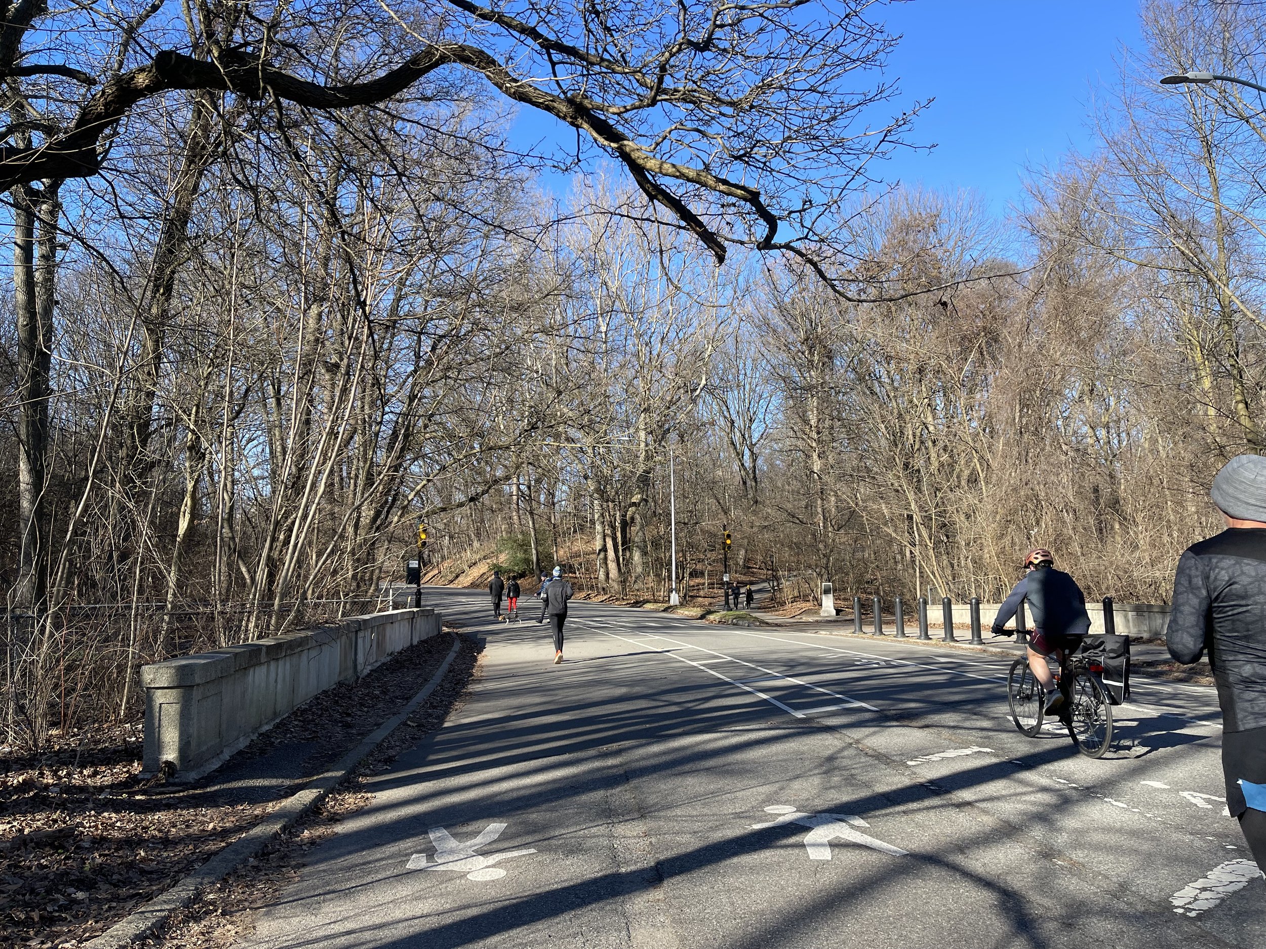
If you’ve lived in Flatbush, you have probably struggled up the moraine yourself. It’s the hill that will make you sweat on a sunny day when riding your bike around Prospect Park, walking across Park Slope, or hiking to the best view in Green-wood Cemetery. It’s the oft-mentioned hill that ran along Ebbets Field. It’s the “Heights” in Crown Heights and Prospect Heights (and Greenwood Heights, if we’re really doing that), the “Slope” in Park Slope, the “Ridge” in Bay Ridge, and the same “Guan” that’s in Guan-us (Gowanus).
The terminal moraine’s strength against humans has also gifted us the last natural forest in Brooklyn — the untouched woodlands of Prospect Park — and visiting it is truly awe-inspiring, even if you’re not a nerd like me. A good way to explore is to find the plaque that denotes the Dongan Oak, then walk up the bike path to the plaque that denotes Battle Pass. Then, wander into the interior of the park, away from the street and the bike path. Find a trail that winds around the hill, and imagine what this space looked like when the terminal moraine was new, and waterfalls were creating giant rivers below.
Surprisingly, this stretch of the imagination is not hard, even 12,500 years later. The air feels fresh, the cliff is high, and the area is absolutely littered with river rocks — the type of smooth, round stones you’d normally find near water. Some have stripes from sedimentary layers; others are soft enough to break apart in your hands. Many of them sparkle, from mica and other minerals I have yet to learn. (The occasional liquor bottle or condom reminds you that you’re still in New York, and that you should wash your hands when you get home.)
Believe it or not, the Laurentide Ice Sheet, which shaped those rocks and the landscape all around them, still exists…for now. Once 1,000-feet thick when it ruled New York, it’s living out its life in the Inuit territory of Canada as a simple ice cap. It only has about 300 years before it melts completely.
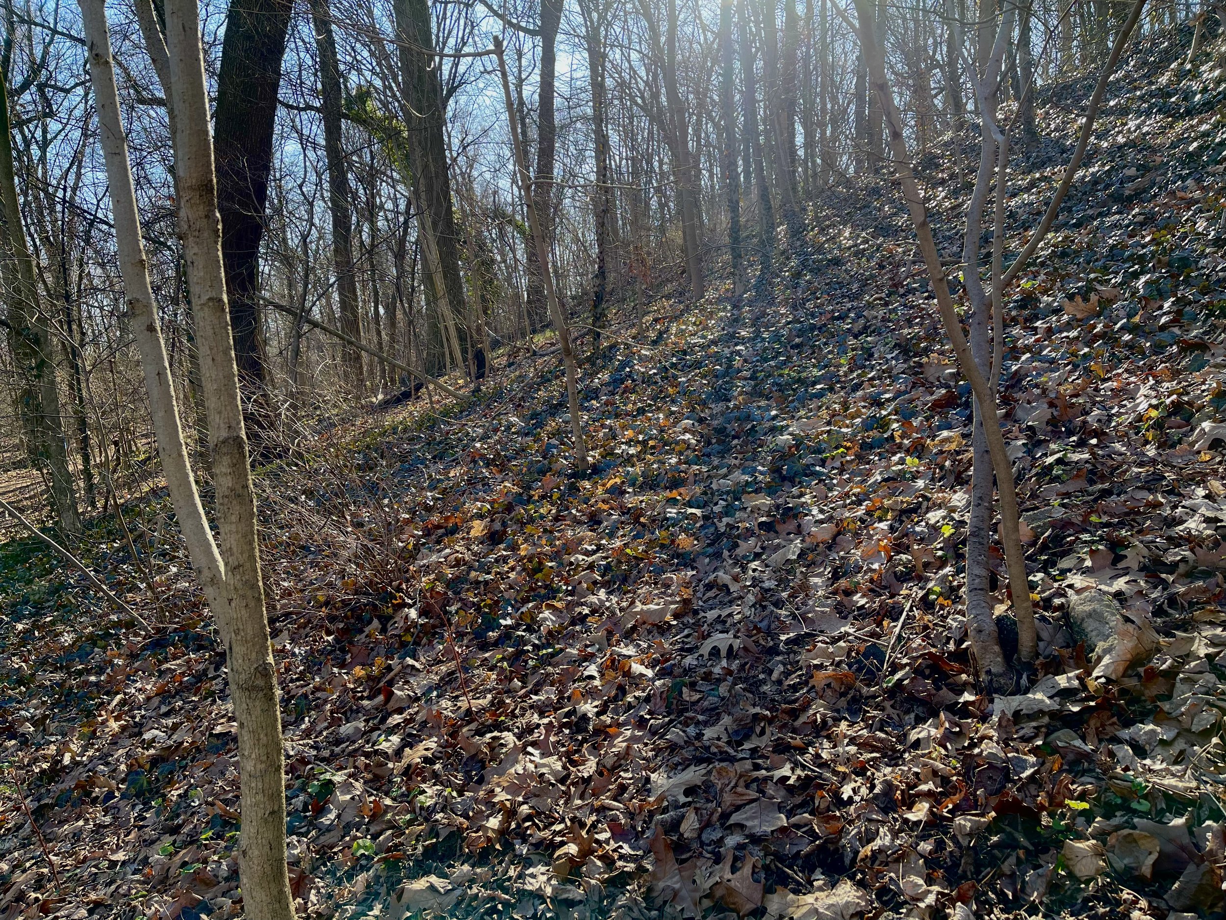
Now a steep hill covered in forest, the terminal moraine in Prospect Park is an incredible opportunity to explore the natural terrain of Flatbush. Find it by walking into the interior of the park, away from the street and bike path, in between the the Dongan Oak plaque and the Battle Pass plaque.
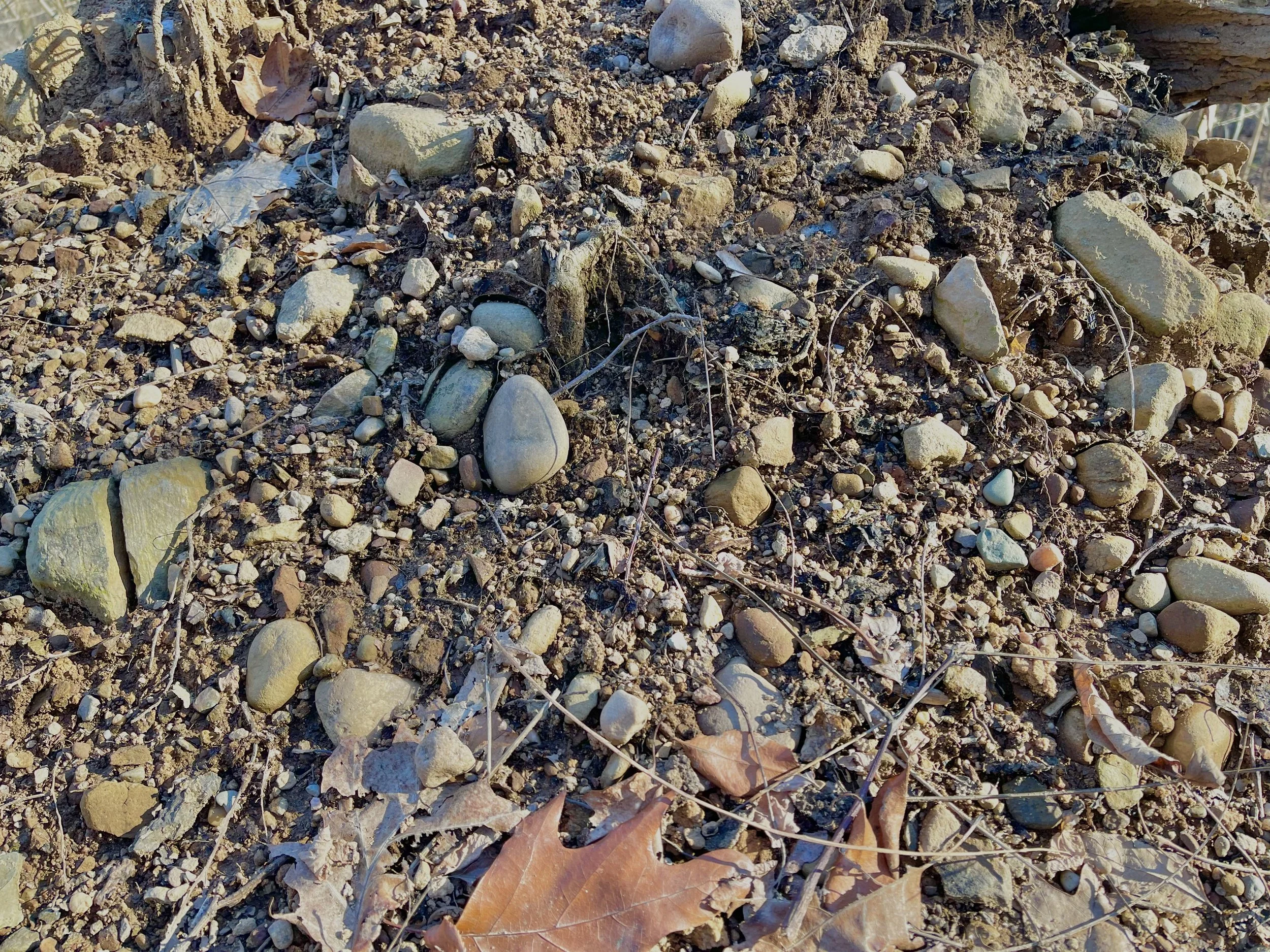
At the base of a fallen tree, hundreds of smooth, multi-faceted rocks are exposed. Formed by the ancient rivers in this area, searching through them is as fun as sifting through shells at the ocean, thanks to their diversity, beauty, and occasional sparkle. On many of the rocks, like the large one on the left that appears broken apart, you can clearly see lines from layers of sediment being pressed down over time.
This article was written in 2022–2023 using the following sources:
In Suspect Terrain by John McPhee (a truly wonderful book for any non-experts interested in New York City geology)
Geology of the New York City Region by Phil Stoffer
Travels in Geology: Exploring Connecticut's Ancient Rift Valley by Terri Cook, Earth Magazine
The Top 12 Historical Secrets of the Gowanus Canal by Michelle Young, Untapped Cities
The Quarry That Built Boston and New York City by Doe Boyle, Connecticut Explored
How the Ice Age Shaped New York by William J. Broad, NY Times
Fossils Through Geologic Time, National Park Service
Hot Rocks: A Geological History of New York City Parks, NYC.gov
So Long, Last North American Ice Sheet by Amy Imster, EarthSky
Interested in doing your own Flatbush research? Visit the Resources section.
More things to learn about…


When telephones were the latest new-fangled tech in Flatbush, including a rundown of old Flatbush exchange names.